Skip to content
Take our survey — win Hawaii apparel
Hawaii.com
Hiking on Hawaiʻi Island

Hiking on Hawaiʻi Island

Volcano craters, a 13,803-foot summit, valley descents and lava-coast trails — the most varied hiking in Hawaiʻi.

Sarah Burchard
By Sarah BurchardLast verified: July 2026Expert verified

Reserving only an afternoon to hike Hawaiʻi Volcanoes National Park was nonsensical — we gave it our best, but there was just too much ground to cover in this wonderland of ecosystems. Hiking trails on Hawaiʻi Island vary wildly depending on where you are: coastal, lowland, mid-elevation woodland, rainforest, upland forest, subalpine and alpine terrain all exist within Volcanoes National Park alone — plus an active volcano. Two hours away by car, the summit of Maunakea — the tallest mountain on earth at 13,803 feet — sits in the periglacial zone: freezing, dry and treeless. If hiking across lava rock and up frozen tundra isn't your thing, you can hike to vast valley lookouts, the 442-foot ʻAkaka Falls, or down to the ocean to swim out to the Captain Cook Monument, reachable only by boat or trail. Whichever you choose, hiking on Hawaiʻi Island is like nowhere else on earth. (A note on the name: the island's official name is Hawaiʻi Island; because many visitors know it as the Big Island, we use that name below.)

Volcanic

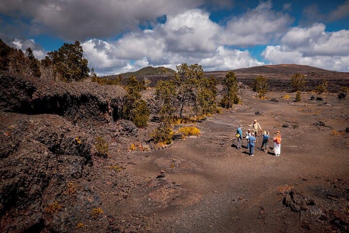
The Big Island doesn't offer one hiking experience — it offers several, stacked on top of each other across an island still actively being shaped by volcanic activity. Hawaiʻi Volcanoes National Park is the most ecologically diverse hiking destination in the state: 150-plus miles of trail through lava fields, rainforest, crater rims and coastal cliffs. The signature hike, the Kīlauea Iki Trail, takes you four miles into a crater and across a solidified lava lake; the Crater Rim and Halemaʻumaʻu trails offer more accessible volcanic views without the full descent; and the Kīpukapuaulu Trail winds through an older forest surrounded by lava flows — one of the quieter, more underrated walks in the park. Conditions shift with volcanic activity, so always check the park's alerts before heading out. Away from the park, on the northern edge of Hualālai volcano, the 3,967-foot Puʻu Waʻawaʻa cinder cone is a drier, less-crowded summit hike through native dry forest with views of the Kohala Coast — one of the most overlooked hikes on the island.

High-Altitude: Maunakea

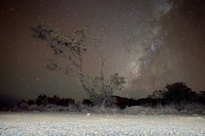
Maunakea, sacred in Native Hawaiian culture, is in a category of its own: a summit hike at 13,803 feet that requires acclimating at the Visitor Information Station at 9,200 feet for at least 30 minutes before continuing. The altitude is serious and conditions at the top can be severe. Thirteen observatories housing 21 telescopes sit above the clouds at the summit. Tour companies run guided sunrise, sunset and stargazing experiences for those who don't want to hike it independently — highly recommended.

Valleys

The Big Island's valleys are among the most dramatic on earth. Pololū Valley, on the North Kohala coast, offers a short, steep descent — roughly 0.9 miles and 420 feet of switchbacks down to a black sand beach with emerald sea cliffs rising on either side. The hike takes about 20 minutes each way, but the view from the overlook alone is worth the drive. You can no longer hike down into Waipiʻo Valley — the access road is closed to non-resident pedestrians — but you can drive to the Waipiʻo Valley Lookout for its waterfalls and taro fields, just steps from the parking lot. Nearby on the Hāmākua Coast, the 442-foot ʻAkaka Falls is reachable by an easy quarter-mile paved loop.

Coastal

The best coastal hikes are on the Kona side. The Captain Cook Trail descends about 1,300 feet to Kealakekua Bay, where you can swim and snorkel around the Captain Cook Monument — reachable only by trail or by boat. Makalawena Beach, in Kekaha Kai State Park, takes a two-mile round-trip hike over ancient lava flows to reach its secluded white sand and calm water.

Maunakea Altitude

Maunakea is the tallest mountain on earth measured from its base on the ocean floor, and its 13,803-foot summit sits in conditions most visitors are not prepared for. The altitude gain from sea level to summit is roughly equivalent to the climb from Everest base camp to the top. The drop in oxygen and atmospheric pressure can cause altitude sickness, which can escalate to life-threatening High Altitude Pulmonary Edema or Cerebral Edema. The mandatory first stop is the Visitor Information Station (Hale Pōhaku) at 9,200 feet, where you must acclimate at least 30 minutes, register, and use the buddy system.

Do not travel above the Visitor Information Station if you are under 13, pregnant, intoxicated, have scuba dived in the past 24 hours, or have high blood pressure or heart or respiratory conditions. Descend immediately and seek medical attention if you experience headache, nausea, shortness of breath, impaired judgment or loss of balance.

A dependable, fully operable 4WD or AWD vehicle is required for summit travel. The eight-mile summit road climbs nearly 5,000 feet, with unpaved single-lane sections, and most rental contracts explicitly prohibit it. The summit closes to visitors 30 minutes after sunset, and winter can bring snow, ice and 100-mph winds at any time of year.

Maunakea is also sacred ground. Since the first telescope was built on the mauna in 1964, there has been ongoing conflict between Native Hawaiians and those seeking to build more observatories, most recently a proposed 30-meter telescope. In Hawaiian culture the ʻāina — the land that feeds us — is not property but kin, and Hawaiians carry a responsibility to protect and care for it.

Hiking Hawaiʻi Volcanoes National Park

Hawaiʻi Volcanoes National Park holds more than 150 miles of trail across one of the most geologically active landscapes on earth. Entry is $30 per vehicle for a seven-day pass. Trails open and close based on eruption activity, volcanic gas levels and trail damage — check conditions and alerts at nps.gov/havo before you visit. Conditions here change faster than at any other national park in the country.

The signature hike is the Kīlauea Iki Trail: four miles round-trip, descending 400 feet into a crater that last erupted in 1959, crossing the solidified lava lake on the crater floor, and climbing back out through rainforest. The floor is still warm in places.

The Crater Rim Trail and the walk to the Halemaʻumaʻu overlook are the most accessible volcanic experiences in the park — well-maintained paths with caldera views that don't require hiking shape, the best choice for the experience without the strenuous descent. Devastation Trail is a 20-minute paved walk through a landscape blanketed by 1959 cinders, and the Kīpukapuaulu Trail moves through a rare native forest — one of the best birdwatching walks in the park.

Volcanic activity on Kīlauea's summit is always changing, and the glow from Halemaʻumaʻu Crater varies week to week. Check current eruption status before planning your visit around it — the park is extraordinary whether or not Kīlauea is erupting.

Waiale Waterfalls hike and swim with Native HawaiianHawaiʻi IslandFree cancellation

Waiale Waterfalls hike and swim with Native Hawaiian

What makes this experience unique from others in Hawaiʻi is genealogy, fun, and world saving knowledge! The magic of the Hawaiian islands is unlocked through oratory! This experience stands alone compared to others with its use of ʻŌlelo Hawaiʻi, Hawaiian language learning and exploration as we explore and swim in the waterfalls of Hilo together, we will learn about place names, endemic plant names, and environmental processes that generate all the life of our island and all our waterfalls! In Hawaiʻi what makes us unique to many places around the world is that we remember our connections to nature! Those connections are woven into all of the waterfalls, plants, mountains, agriculture, politics and even daily values! These connections for us give us an immense love for all life, as we explore together the beauty of Hawaiʻi, we will be inspired by the love of the land! Love to share for the rest of our planet.

5.0(4)2h–3h
From $200Book Now
Guided Hike Adventure: Kilauea Iki and Lava TubeHawaiʻi IslandFree cancellation

Guided Hike Adventure: Kilauea Iki and Lava Tube

The Kilauea Iki Crater is known for its hardened lava lake from the 1959 eruption, which provides a glimpse into the volcanic activity of the past. On your trek through Kilauea Iki Crater you will have unparalleled views of lava formations and unique landscapes formed by volcanic activity. The contrasting colors of the hardened lava against the lush green surroundings make for a visually stunning experience. One of the highlights of this hike is the opportunity to explore a lava tube, a natural tunnel formed by flowing lava. Our experienced guide will be by your side during the trek ensuring not only your safety but also provides valuable insights into the history, geology, and ecology of the area. They will enhance your overall experience by pointing out interesting features and sharing their expertise.

5.0(1)4 hr 30 min
From $150Book Now

Browse by Category

Sarah Burchard

Editor's Pick

Whatever you read online about Hawaiʻi Island's “green sand beach,” Papakōlea (also called Mahana Beach) is not a place for visitors. If you're offered a truck ride from the parking lot, decline — the land between the trailhead and the beach is Hawaiian Home Lands, and vehicular access is prohibited. The people offering paid rides are operating illegally on fragile ground that holds ancient heiau and culturally significant sites. The hike itself is 2.5 miles each way over open, exposed terrain with high winds and no shade. We don't advise or condone it.

— Sarah Burchard

Insider Tips

Know Before You Go

  1. 1Maunakea is not to be taken lightlyThe drive from sea level to 13,803 feet covers an altitude gain few visitors have ever experienced. You must stop and acclimate at the Visitor Information Station at 9,200 feet for at least 30 minutes before continuing, to avoid altitude sickness. A 4WD vehicle is required on the summit road, and most rental companies explicitly ban it in their contracts. Sunset draws the largest crowds, but the summit closes to most vehicles 30 minutes after sunset, and winter can bring snow, ice and violent winds at any time. If you're considering it, we highly recommend hiring a local guide.
  2. 2Volcano conditions changeHawaiʻi Volcanoes National Park trails close and reopen based on eruption activity, sulfur dioxide gas levels and trail damage. Check conditions and alerts at nps.gov/havo before every visit, as closures can happen overnight. Halemaʻumaʻu glow visibility varies week to week and is not guaranteed — but the park is extraordinary whether or not Kīlauea is erupting.

Related Guides

Frequently Asked Questions

Sarah Burchard
Sarah Burchard

Editor · Oʻahu

Sarah Burchard has called Oʻahu home since 2017. com, Hana Hou, FLUX Hawaiʻi, Forbes, Hawaiʻi Magazine and Honolulu Magazine.

More from Sarah →